 Click a section to zoom in. These are


Description
Chirbury, and Brompton and Rhiston, Shropshire and Montgomery, Powys
Nucleated village and scattered farmsteads with early medieval and medieval defensive earthworks along the boundary between England and Wales, including Mercian boundary dyke and burh, Norman mottes and medieval moated site.
Historic background
The character area comprises parts of the 19th-century townships of Winsbury, Chirbury, Dudston, Timberth, Marrington, Walcot, and Hockleton in the ecclesiastical parishes of Chirbury, Shropshire, in the diocese of Hereford, part of the parish of Montgomery, Montgomeryshire, in the diocese of St Asaph, and the parts of the townships of Rhiston, Brompton and Churchstoke in the English portion of the parish of Churchstoke, again in the diocese of Hereford.
Early prehistoric activity in the area is represented a Neolithic axe found near The Ditches and by cropmark ring-ditches representing Bronze Age round barrows to the south of Rownal, north of Chirbury, and to the north of Whitley. Roman settlement is indicated by a ditch containing Roman pottery sealed beneath the medieval motte at Winsbury, and it is probable that this relatively low-lying area was relatively densely settled at this time and during the preceding Iron Age, settlement possibly based on ditched enclosures known from aerial photography at Brompton, near Blackford Farm, Great Moat Farm, Poundbank, Rockley Wood, Timberth, Walcot, Whitley, Winsbury, to the west of Hollybush Cottages, and between Great Moat Farm and Homeleigh. Little is known of settlement in the area during the later Roman period, but Anglo-Saxon settlements of the 8th and 9th centuries probably began to be established as the kingdom of Mercia gradually expanded westwards, taking over territories formerly held by the British. Place-names of this period containing the tun place-name element meaning a homestead or village, as in Hockleton, Stockton, Dudston, Marrington, and Rhiston. Some settlements at this or later date were possibly occupied by free or enslaved Britons, as suggested by the Walcot, north of Chirbury, whose name includes the elements walh ‘Welshman’ and cot/cote ‘cottage’ or ‘shelter’. The dyke defining the western edge of the character area, built by king Offa before his death in 796, marked the extent of Mercian gains at that date, its alignment suggesting that it was set out across cleared farmland, and its course suggesting a degree of consensus in allowing the British to retain some of the rich farmland and Rhydwhiman, the important ford across the Severn to the north-west of Montgomery.
The Anglo-Saxon Chronicle records that a burh or fortress was built by Aethelflaeda at Chirbury (Cyricbyrig) in 915 and was evidently already a religious centre, the name meaning ‘the fort with a church’. Rather than defending against Welsh attack, however, the western frontier of Mercia was being strengthened at that time against the possibility of Viking attack during the Danish wars. Excavations on the site of the earthwork in the village in the 1950s showed that it was only poorly defended and produced no dating evidence. More recent observations suggest that the burh was a much larger enclosure, built around the village on an axis parallel with its roads.
At the time of the Domesday Book of 1086 the area fell within the hundred of Witentreu, whose name is preserved in the place-name Whittery, just to the east of Chirbury, possibly the site of a moot or meeting place marked by a distinctive tree, which stretched from Long Mountain on the north to the Kerry ridgeway on the south, and from the River Severn on the west to beyond Corndon on the east. Six identifiable settlements in the area are listed in the Domesday Book – Hockleton (Elchitun), Walcot (Walecote), Chirbury (Cireberie), Dudston (Dudestune), Marrington (Meritune), Rhiston (Ristune). In addition to the farmland held by each settlement, Marrington and Rhiston had woodland for fattening 15 and 30 pigs respectively. Chirbury was the principal manor of the hundred, retaining its earlier status, having been held in lordship by King Edward the Confessor at the time of the conquest, and had a church and a priest. However, four of the Domesday settlements in the character area – Hockleton, Walcot, Chirbury in the northern part of the area had been ‘waste’ at the time of the Conquest in 1066. The area had probably suffered during the campaigns against the English by Gruffudd ap Llywelyn in the 1040s, and was being used as a hunting ground by three the Mercian nobles Siward, Oslac and Azor at the time of the Conquest. Of these settlements only Chirbury and Lack had recovered by 1086.
Recovery of the area began once the area came under Norman control, following the fall of the kingdom of Mercia in 1071 and the granting of earldom of Shropshire to Roger of Montgomery. As part of the scheme of recovery the castle of Montgomery was built at Hen Domen in the early 1070s to control Welsh incursions into the area by means of the ford at Rhydwhiman, the Domesday settlements in the character area being grouped within the castlery of Montgomery, gaining protection from the castle but also providing a source of support in terms of materials and garrisoning. By the beginning of the 12th century the Domesday hundred of Witentreu was substantially reduced in size and formed the hundred of Chirbury, by now in the royal county of Shropshire, and in 1233 Offa’s Dyke was fixed as the boundary between Chirbury hundred and Montgomery lordship.
A charter of about 1190 granted a mill at Walcot to a small community of Augustinian canons at Snead (see Wernddu character area). Before 1194 the community transferred to St Michael’s Church, Chirbury, originally the mother church of a large ecclesiastical parish which probably included the whole of the Domesday hundred of Witentreu, with dependent chapels at Montgomery (Hen Domen), Snead, Forden and Hyssington. Consent for the establishment of a priory at Chirbury being granted by the bishop of Hereford in 1201. The carved stalls in St Nicholas’s Church, Montgomery, were brought there from Chirbury at the dissolution.
One of the most distinctive historical features of the landscape are the relatively small and close-set medieval earthwork mottes of which no less than five of which fall within the area, at Hockleton, Winsbury, Dudston, Gwarthlow, and Brompton, forming part of what has been described as ‘perhaps the most remarkable concentration of mediaeval defences on the whole of the Welsh March’ – a number of the mottes being relatively tall and small in diameter at the top, and dating in all probability to the period between the late 11th and early 12th century. These small earthwork castles, mostly built by prominent local landowners, provided a measure of defence and security for their owners and the surrounding area against continuing hostilities along the border. They were in existence by at least 1225 when their owners were commanded to refortify their wooden defences during a period of hostility between Henry III and Llywelyn ap Iorwerth, prince of Gwynedd. Mottes controlled all the important routes into England leading from the ford at Rhydwhiman, and some, like Gwarthlow must have had extensive views of the surrounding countryside.
By the 1240s various tenants within Chirbury hundred held land on the basis of providing fighting men at Montgomery Castle in time of war, and possibly reflecting arrangements dating back to the establishment of the castlery of Montgomery in the 1070s. These properties included those with mottes, as at Hockleton, Winsbury, Brompton and Rhiston, and also included tenants at Timberth, Stockton and Chirbury. By now the new stone caslte built had been built to above the present town of Montgomery to replace the earthen castle at Hen Domen, the duties owed by individual tenants at that time ranging from providing an archer for a day and a night, to providing a man with a horse for three weeks. In time these castle-guard duties were commuted to rents.
The border became generally more settled following the Edwardian conquest of Wales later in the 13th century, With the exception of the short period of unrest at the beginning of the 15th century, at the time of the Glyn Dwr rebellion. It is probably to the period between the later 13th and 14th centuries that the moated site at Great Moat Farm belongs, possibly built as much for show as for defence. Theft continued to be a problem, however, particularly on the part of rustlers preying on the growing trade in cattle rearing, as in 1410 when a herd of 47 animals was stolen at Winsbury and driven into Wales.
During the course of the later medieval period there was probably a gradual consolidation of earlier holdings until by the end of the middle ages the earlier townships which may once have formed small settlements in which a number of villagers shared rights in open arable fields and common pasture and woodland transformed into a pattern of farms worked by individual landowners or tenants. The Augustinian priory at Chirbury continued to acquire land by grant and exchange throughout the middle ages, and became a significant landowner within the parish and beyond, including lands at Caeprior, between Chirbury and Churchstoke. Its income fell with declining cultivation, from the widespread harvest failures and plagues of the early 14th century and by 1423 was said to be ‘in a state of spiritual and material collapse’.
In 1553, following the dissolution of the monasteries, the priory’s holdings were acquired by the Herberts, one of the prominent local gentry families, which by marriage and purchase continued to extend their estate within the area well into the 18th century. Cereal production, cattle rearing and dairy produce continued to be the mainstay of the farming industry, though hop growing took place within the parish in the early 17th century. In the late 19th and early 20th centuries the breeding of agricultural horses was important.
Key historic landscape characteristics
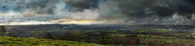
The area forms a major portion of the flat and gently undulating plain of the Vale of Montgomery, bounded on the north valley of the upper Camlad, on the east by Marrington Dingle, on the south by the valley of the Caebitra and on the west by the line of Offa’s Dyke. The area ranges in height from about 80m above OD in the north, where it borders the lower Camlad valley, to about 165m above OD, almost the highest point being occupied by the motte at Gwarthlow. It is crisscrossed by numerous streams which draining into the Caebitra on the south or the Camlad on the north. There are scattered ponds and springs, often near farmsteads. The underlying geology is composed of Ordovician shales on the east and Silurian shales on the west, soils being very largely fine silty and clayey stagnogleys, liable to seasonal waterlogging. There are also scattered areas of deciduous and conifer woodland.
Present-day settlement consists of the village of Chirbury, a number of roadside cottages and smallholdings, with generally large, widely-spaced farms, up to about 1km apart, often set in their own fields rather than along the public roads, some of which are and strung out in a rough line 500-1500m behind Offa’s Dyke and prominently sited on slight rises or ridges. A proportion of these larger farms are the focus of the townships in which they lie and were evidently in existence as settlements by the mid 11th century.
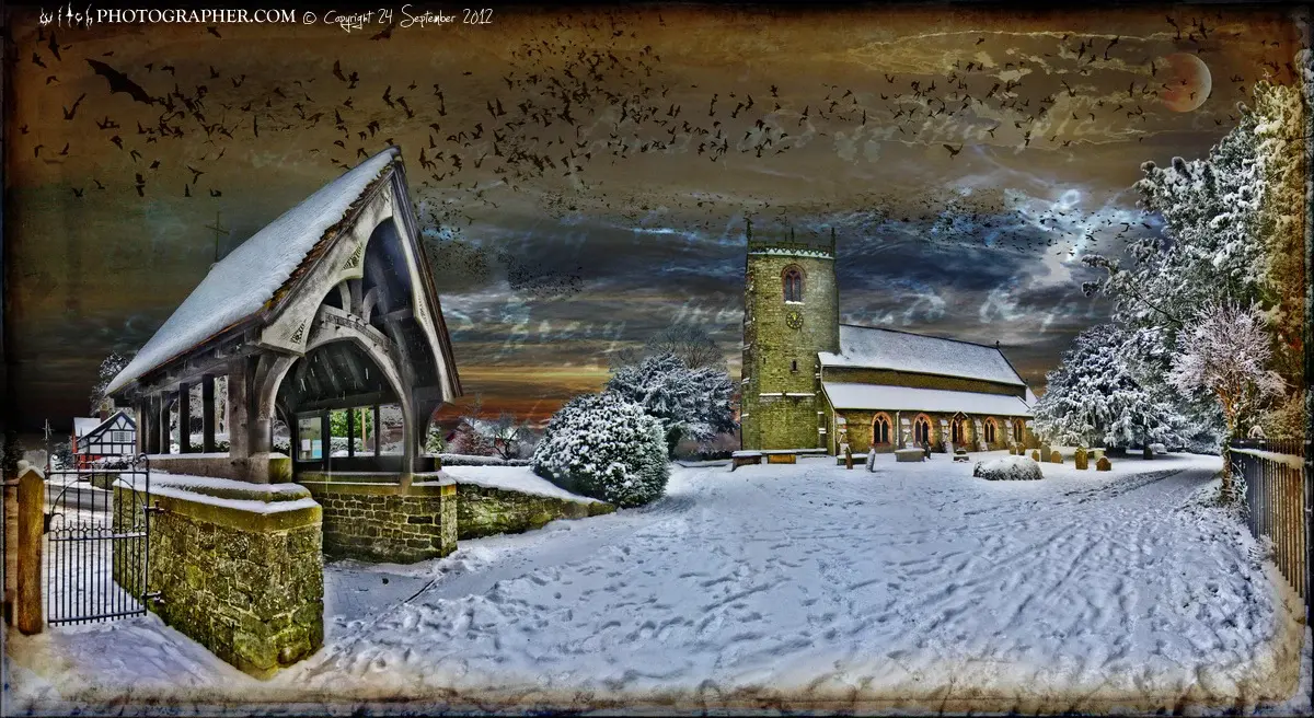
Chirbury village is centred on St Michael’s, a large medieval church, the nave of the former priory church of the Augustinian canons, which became the parish church following the Reformation. The original transepts and chancel are now missing but there is an isolated 13th-century compound pier in the churchyard which is all that remains visible of the rest of the monastic complex, though other worked stones from the former priory survive in the grounds of Chirbury Hall. A brick chancel was to the church in 1733. Other buildings in the village include the 17th-century timber-framed school house and former school and outbuildings to the south-east of the church, Chirbury Hall, an early 18th-century stone house with brick dressings remodelling an earlier building, and with octagonal brick pigeon house, 17th/18th-century timber-framed cottages, 18th-century stone houses and cottages, and 18th/19th-century brick buildings including the School House and former house which is now the Herbert Arms Hotel, together with some modern houses. There are several working farms within the village with weather-boarded barns on stone footings and 18th/19th-century barns of quarried stone, and some steel-framed farm buildings and wooden-posted dutch barn. An interesting complex of buildings to the north of Chirbury Hall includes a 17th-century timber-framed and weather-boarded barn and a brick horse engine house. Other buildings include the early 20th-century brick-built village hall. The timber-framed and weather-boarded former blacksmith’s shop also survives.
A significant number of timber-framed buildings have survived in the countryside, with late 16th to 17th-century timber-framed farmhouses Sidnal, Rhiston, Rockley with 18th to 20th-century extensions, often in brick, and timber-framed cottages Lower Lane Cottage and the Old House, near Homeleigh, and to the south-west of West Duston. A number of late 16th to 17th-century timber-framed farmhouses are now encased in stone or brick, as in the case of Great Moat Farm, Upper Gwarthlow, and Timberth. Later than these appear to be the ?18th-century stone farmhouse at Coed Farm, and a stone cottage near Rockley Wood. 19th-century and later buildings are almost invariably in brick, including the farmhouses at Winsbury, Homeleigh, Caeprior, Lower Gwarthlow, West Dudston, the remodelled farmhouse at East Dudston, and the roadside cottages at Red House, Cross House, Poundbank, Hollybush Cottages. A significant number of early farm buildings have also survived, including 17th-century timber-framed barns, cowhouses or threshing barns at Rockley, Sidnal, Heightley, The Ditches, and Upper Gwarthlow, usually with weather-boarded and set on random stone sleeper walls, and occasionally with gables walls replaced in brick or stone. There are also stone barns near the Old House, Sidnal, Coed Farm, and the remnants of earlier stone building at Lower Gwarthlow. A number of earlier buildings are weatherboarded, as at Old House, Timberth, Sidnal, Rhiston, Coed Farm, Upper Gwarthlow, some of which are on stone footings. 19th/20th-century brick outbuildings are fairly widespread, as at Homeleigh, Timberth, Caeprior, Rhiston, Lower Gwarthlow, Winsbury, with an 18th/19th-century brick hay barn at Upper Gwarthlow. Most of the larger farms have 20th-century steel-framed farm buildings. The tall 20th-century grain silos at Timberth, Lower Gwarthlow, West Dudston, Winsbury and the lower silo at Sidnal, are a particularly distinctive feature of the present-day landscape.
Marrington Hall, on the western edge of Marrington gorge on the eastern edge of the character area, was the centre of one of the few small estates in the character area, to which Middle and Upper Alport belonged (see Marrington Dingle character area). The estate was probably based on one of the two manors at Marrington mentioned in the Domesday Book, the present hall being a small mid-Victorian Elizabethan-style half-timbered country house incorporating a late 16th-century timber-framed house, the earliest building perhaps associated with a sundial of 1595 erected by Richard Lloyd and inscribed ‘FROM DAI TO DAI THESE SHADES DO FLEE AND SO THIS LIFE PASSETH AWAIE’, originally set within its gardens.
Present-day land-use is a mixture of pasture and arable, with some fodder crops. Relatively large fields, generally with low-cut multiple-species hedges including hazel, hawthorn, and holly, with scattered mature oaks in the boundaries and alders and willows along streams. Many of the boundaries appear to have been set out in relation to streams or contours. Many boundaries are irregular, suggesting piecemeal clearance, though some are straighter and suggest subdivision of larger original units, with irregularities in some boundaries due to amalgamation of earlier fields. There aare some recent and some older, grown-out laid hedges, with some abandoned hedges now represented by intermittent lines of trees or shrubs. There are also occasional low field banks. The present-day field pattern is broadly the same which had come into existence by the mid 19th century, except for some field amalgamations. Occasional field ditches, such as those in the area to the west of Marrington Hall, represent land-improvement schemes which in some instances may be 17th/18th-century or earlier in date.
There are numerous remains of ridge and furrow representing medieval open-field arable cultivation on all sides of Chirbury, those on the south pre-dating the Chirbury-Churchstoke turnpike road (A490). Areas of ridge and furrow also survive in association with a number of the outlying townships, as for example near Sidnal, Winsbury, and West Dudston.
A number of the major roads in the area are of relatively recent date, including the main roads between Chirbury and Montgomery (B4386) and between Chirbury and Churchstoke (A490), being late 18th-century turnpike roads. The Montgomery-Chirbury road dates to after 1768 and replaces an earlier twisting lane, the course of which is visible in places, an early 19th-century milestone surviving on the turnpike road near the turn to Crankwell Farm. An old lane from Montgomery to Chirbury also ran via Little Lymore and the medieval motte at West Dudston and is represented by footpaths and hollow-ways. The earlier road between Chirbury and Churchstoke is the winding lane which runs in a hollow-way up to 1m deep via Homeleigh and Caeprior and the green lane between Cross House and Coed Farm.
An ancient route between the ford across the Severn at Rhydwhiman and Churchstoke via Lymore Park, Gwarthlow motte, and Rhiston, is marked by footpaths and field boundaries and an existing road. Medieval settlements at Winsbury, Dudston, Great Moat Farm, and Rhiston are interconnected by a series of lanes and footpaths which are probably of considerable antiquity. Bridges include Whittery Bridge (a 19th-century stone bridge with brick arch and stone vousoirs across the Camlad), Chirbury Bridge (an 18th-century single arch stone bridge across the stream on the Chirbury to Montgomery road), and two smaller ?early 19th-century single-arch bridges across the same stream to the south of Chirbury (one with a stone arch on a farm track and one with a brick arch brick bridge on the minor road to Homeleigh Farm). Small-scale extraction and manufacturing industries are represented by disused marl pits, gravel pits, clay pits and brickworks in the area of Chirbury, Walcot and Whittery Bridge, shown on Ordnance Survey maps dating to the end of the 19th century.
The earthwork monuments of the Chirbury area are important landscape features, and include an earthwork camp, several medieval mottes, a moated site, an earthwork enclosure, and Offa’s Dyke which bounds the western side of the character area.
Ornamental landscapes in the area include gardens at Chirbury Hall and Walcot. Some of the plantings survive in the parkland to the west of Marrington Hall, shown on Ordnance Survey maps of the 1880s, together with stone entranceway and 19th-century stone-built lodge with brick dressings.
cpat.org.uk


Reviews
There are no reviews yet.